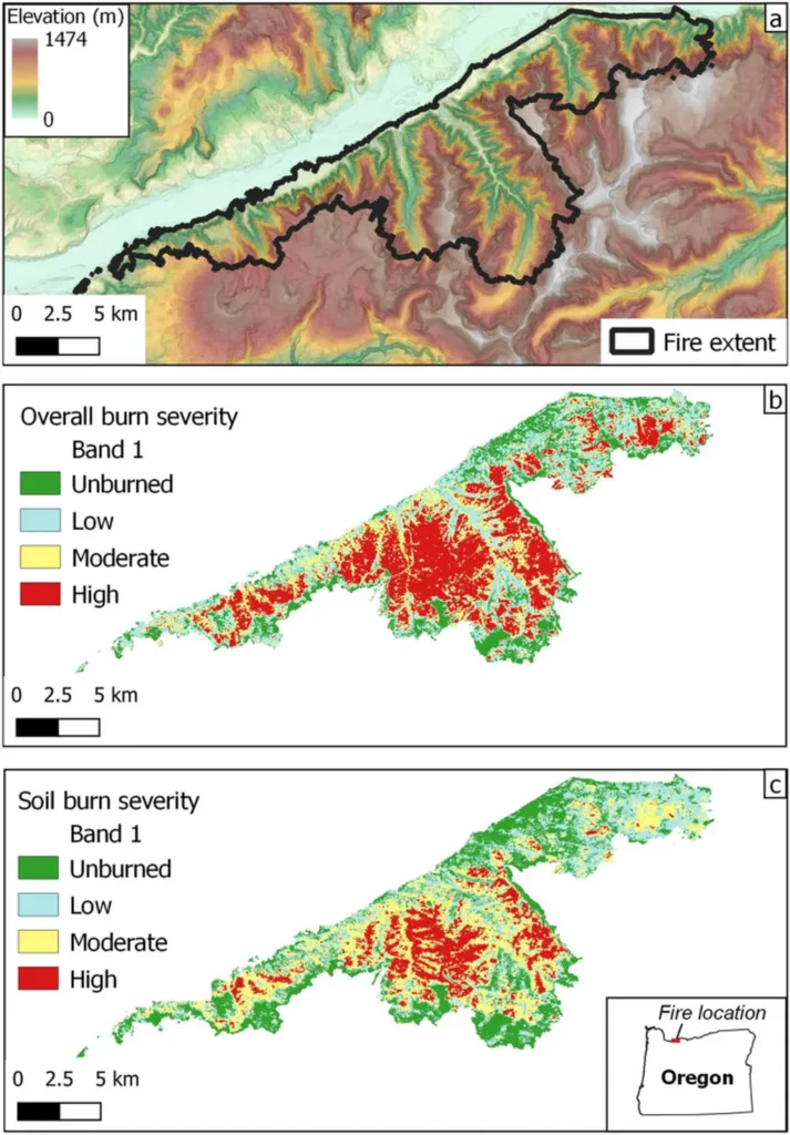
In the heart of Oregon, the Beachie Creek Fire left a significant mark, not just on the landscape but also on our understanding of wildfire impacts. A recent study published in the journal “Indicators of the Ecological Environment” has shed new light on how we can more accurately estimate biomass consumption and carbon emissions from such events. The research, led by Liang Cui from the College of Geo-Exploration Science and Technology at Jilin University, integrates data from the Global Ecosystem Dynamics Investigation (GEDI) mission with Sentinel-1 and Sentinel-2 data to provide a more precise picture of the fire’s aftermath.
The study employs a three-phase model that begins with developing canopy height models (CHMs) using GEDI’s light detection and ranging (LiDAR) measurements. “By combining GEDI’s canopy height data with multi-source remote sensing variables, we were able to create detailed pre- and post-fire CHMs,” explains Cui. This phase sets the stage for the subsequent steps, which involve estimating aboveground biomass (AGB) and ultimately calculating carbon emissions.
The integration of radar data from Sentinel-1 and optical data from Sentinel-2 allows for a comprehensive analysis that captures the spatial heterogeneity of biomass consumption and carbon emissions. “Our approach provides a more nuanced understanding of the fire’s impact, particularly in areas with high burn severity,” says Cui. This level of detail is crucial for the energy sector, as accurate estimates of biomass consumption and carbon emissions can inform carbon trading markets and help companies meet their sustainability goals.
The study’s findings reveal that the Beachie Creek Fire resulted in 8.81 Tg (±2.9 Tg) of biomass consumption and 14.54 Tg (±4.78 Tg) of carbon emissions. These figures not only contribute to our understanding of the fire’s environmental impact but also have commercial implications. For instance, companies involved in carbon offset projects can use this data to validate their claims and ensure they are effectively mitigating carbon emissions.
The research also highlights the potential for this methodology to be applied to other regions. “Our framework is efficient and scalable, making it suitable for assessing burning emissions across large and remote areas,” notes Cui. This scalability is a significant advantage for the energy sector, as it enables companies to monitor and manage carbon emissions more effectively, even in hard-to-reach locations.
As the world grapples with the challenges of climate change, accurate and reliable data on carbon emissions is more important than ever. This study not only advances our scientific understanding but also provides practical tools for the energy sector to contribute to climate change mitigation strategies. By integrating GEDI, Sentinel-1, and Sentinel-2 data, Liang Cui and his team have opened new avenues for research and commercial applications, paving the way for more informed and effective forest conservation and fire management policies.